I do know a lot about Europe, and everyone I know there actually owns a car, with some owning several. I just found the statement about car ownership so ridiculous that I had to quote it.
1 Like
The current hardware running the routing backend simply isn’t up to the task. The routing engine needs at least 128 GB of RAM to run comfortably, and I got quite a shock when I looked up the current prices. 
There’s no need for any more Sailfish apps.
Everything anyone could ever need has already been developed.
I don’t know why people still try to develop for this platform.
Don’t they have anything better to do than create software for other people to use for free and then still complain about it?
5 Likes
The limiting factor is only the hardware the routing engine currently runs on.
More or less. For everything else you can use PureMaps or OSM Scout which are way more flexible.
This one was designed with simplicity in mind. It’s not meant to be used by people with a computer science degree. No API keys, no setup. You type in a destination and off you go.
1 Like
@cypherpunks - I appreciate your willingness to do this. By any chance, are you in the Chicagoland area? If so, I have a Dell R740xd with dual gold 12C processors and 192GB of RAM, 24 2.5" drive bays on PERC 730, iDRAC Enterprise, i believe quad 10GbE, dual 1100W power supplies.
I got 19 of them for my business and have deployed 18 of them. This is the last. If it helps the community, I’m willing to donate it to the cause.
But I really don’t want to pack and ship it elsewhere. So that’s why I ask if you’re near Chicago.
5 Likes
The hordes that have overrun Europe**, brought their camels with them. Most people travel by camel and cook on smouldering dung now. It is a huge improvement over trudging home, to stare balefully at an stove that formerly burnt gas, while turnips ferment in cold water for the evening’s gruel.
** my information about life in EU comes from a reliable source - the US Government
1 Like
I’m interested. Very much so. But located in Colorado.
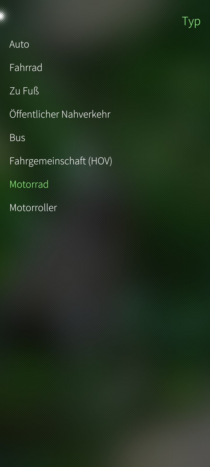
I think there is a need for a native navigation app that supports esp. scenic routes or routes for motorcycles. Here Wego has a mode for motorbikes and bicycles but it is AAS, collects data and is not very good with motorbike routing.
In rural Europe people largely depend on cars for transportation as public transport is scarce there whereas in larger cities owning cars is very slowly becoming less common.
If somehow the navigation app uses traffic data from -no idea where you can get these data open- it would be a nice alternative to the current apps. As far as I know they show the fastest or sortest route, but without the traffic load, which can make hours of difference per week.
1 Like
Some app use waze data, no authorized but work well. Crowdsourced Alerts (Police, Hazards) - Highway Radar Book
Thank you for your kind offer. I’m not in the Chicago area, but I have all of Illinois in the dataset, so if you’d like to test the app yourself, feel free to PM me for a link.
We have more than one there is OSMScout by @karry as well. But I agree having options can’t be wrong.
1 Like
Both have a much broader scope and are intended for much more advanced users.
The whole reason this app exists in the first place is that if I asked anyone to use PureMaps or OSM, they would just use their iPhones instead.
2 Likes
The current setup does not allow for this, but it’s certainly something that could be added in the future.
2 Likes
Let me know when you get west of the Mississippi. My current VW navigator personality is stuck on “Valley Girl”.
1 Like
Yes please!
I’ve been using HERE WeGo for my navigation for quite a while now, but it has pissed me off for the last time!
Love the look of the app from the screenshots.
Is this voice turn by turn navigation? If so, can the voice aspect be turned off?
Thank you.
Yes, but it uses the old pre-recorded style that works even when no TTS app is installed.
The idea was that spelling out street names takes too long and is of questionable benefit when you do not know the street layout, or you would not need a navigation app in the first place.
Yes.
But it was also specifically designed to be less annoying than on pretty much any current Android app.
1 Like
After the initially rather reserved response in the forum, I received several generous offers of help via private messages, both financially and in the form of hardware. Thank you for such a wonderful response when nobody else is looking.
While I cannot take you up on these offers, it is genuinely motivating to see that some people really do care. Thank you again.
For anyone who received the download link, here are a few tips:
On first launch, go to Settings and set the squawk to 1000.
Anything below 2000 will work. Generally it is best to avoid anything ending in x500, x600, or x700, especially anything beginning with a 7.
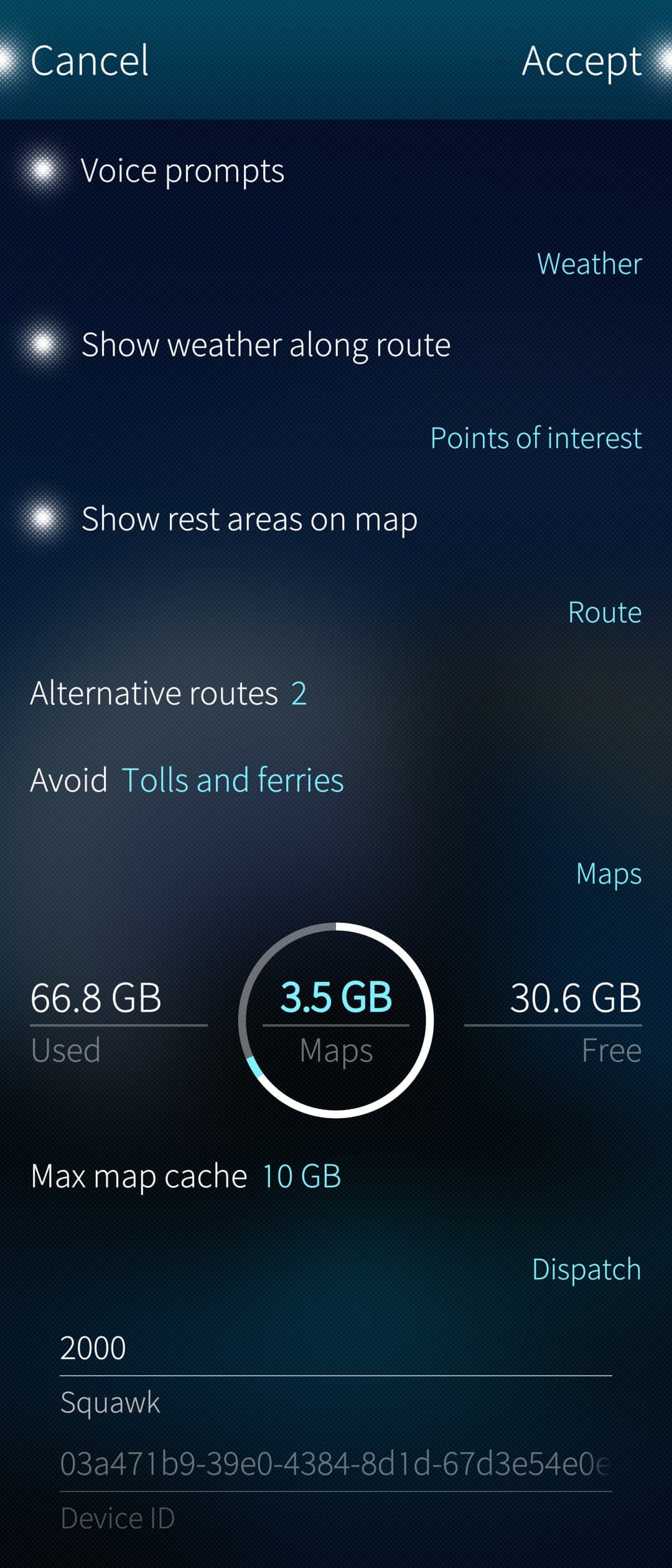
(Nothing bad should happen either way. The police should not turn up even if you set it to 7500, as your device is not registered, but there is no need to spam the dispatch database.)
The Device ID is randomly generated on first launch, so it should not be a privacy issue. It is not even sent to the server when the squawk is set below 2000. The server stores IP addresses in text logs, but they are rotated out regularly and nobody really pays any attention to them anyway.
The same applies to any telemetry, which should be automatically disabled when the squawk is set below 2000.
The Navigation page has two modes
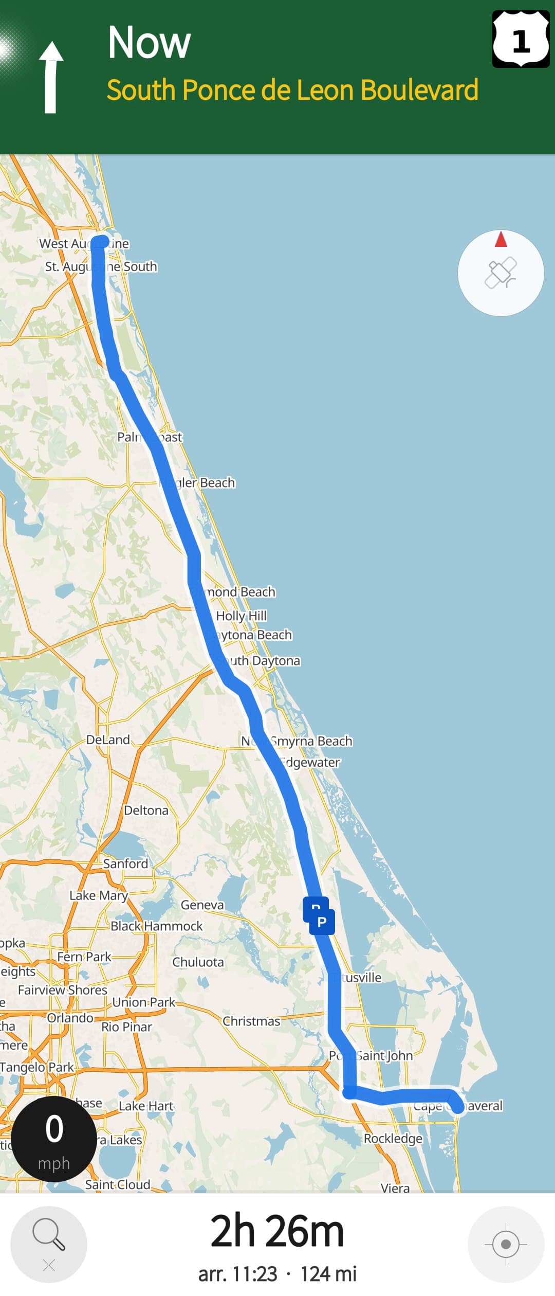
- Planning mode, with the map freely movable but locked north-up (white button).
- Follow mode, with the map locked to the current GPS position (dark button).
You can switch between the two modes by tapping the button in the lower-right corner.
You can switch between north-up, travel direction-up, and perspective mode by pressing the compass rose.
The button in the lower-left corner:
- Tap once to open the Search page.
- Long press to cancel the current route.
Waypoints
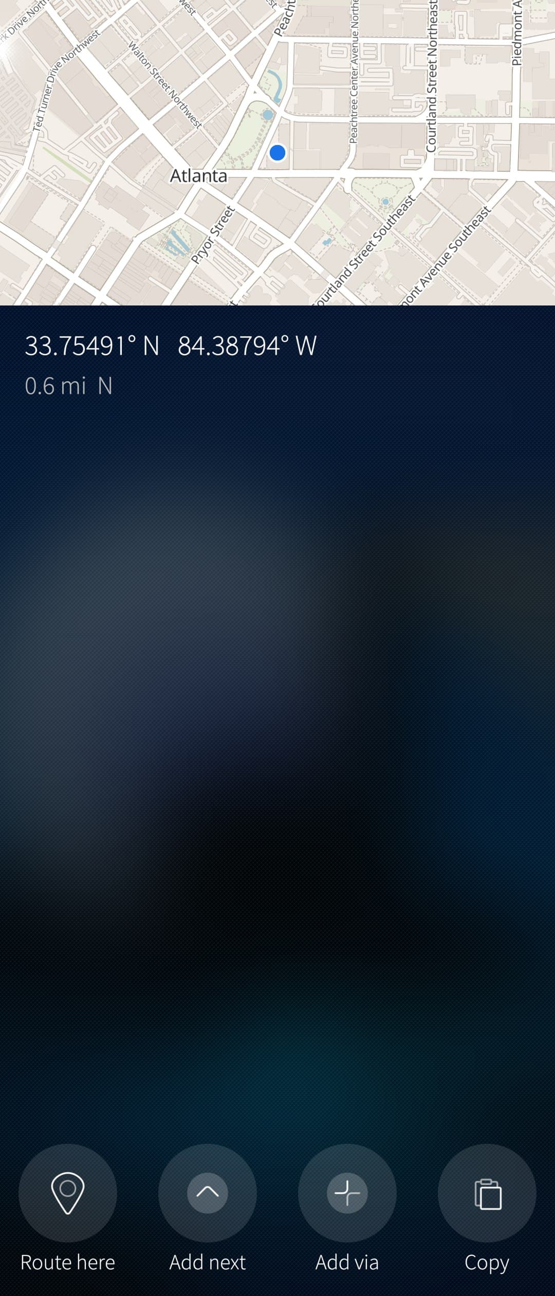
Long pressing anywhere on the map opens a page that allows you to create a route to the selected location or add it as a waypoint.
Waypoints can also be added from the search page or by tapping on a POI on the map.
Weather alerts
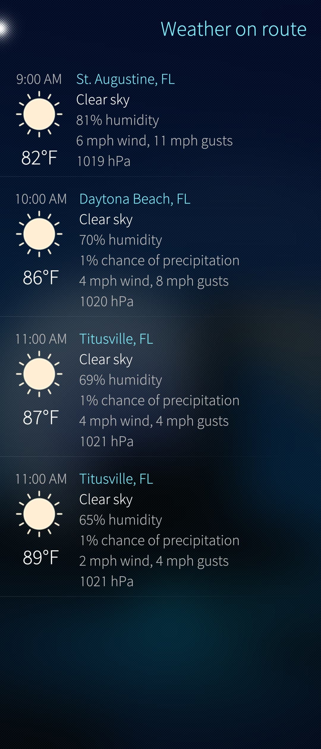
If a yellow triangle icon appears in the bottom row, to the left of the ETA, it means the server has detected severe weather along your route. This may be something as minor as strong wind gusts or fog. Tap the icon to open the Weather page for more details.
The rest should be fairly self-explanatory.
5 Likes